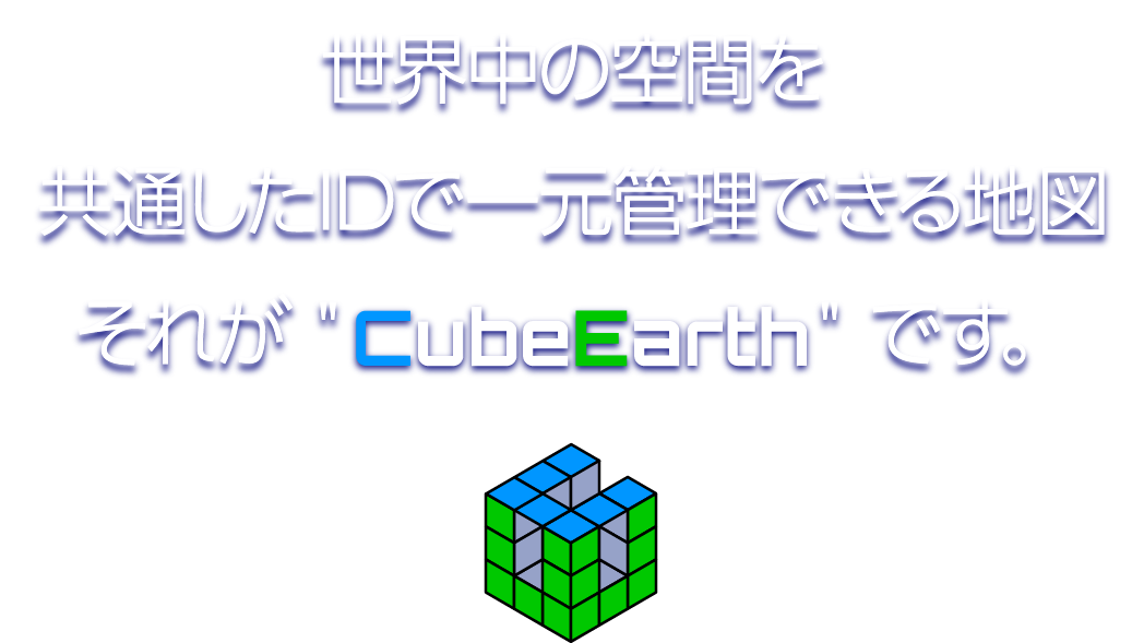

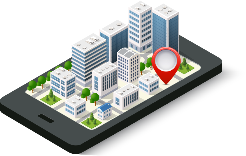
Cube Earthとは
《Cube Earth》について
- ◆地理情報システム(GIS)のプラットフォーム
- ◆国際特許取得済み
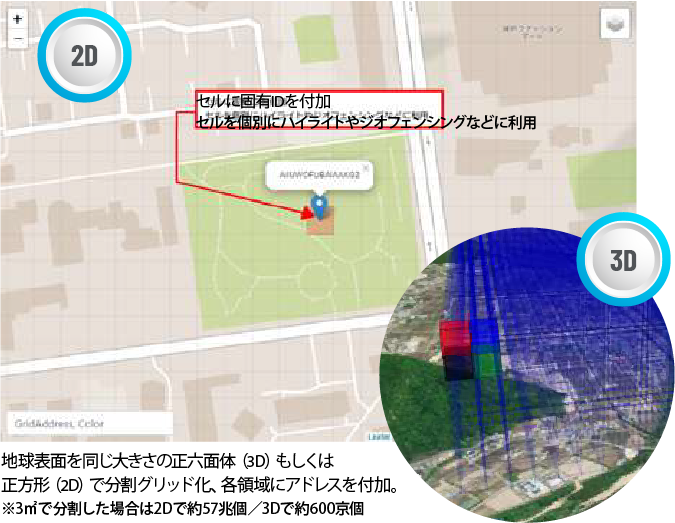
- ◆正方形でメッシュ化し、固有の空間IDを発行
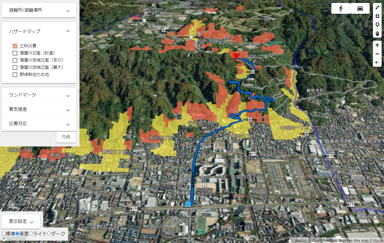
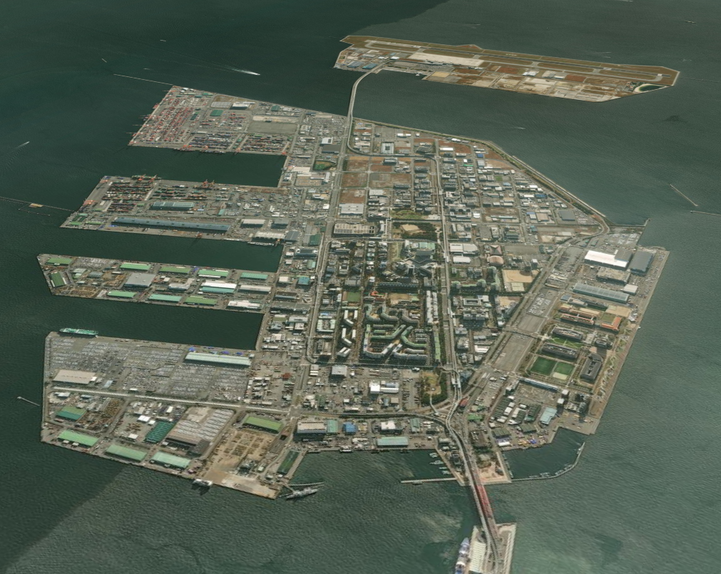
- ◆大阪府大東市の防災システム構築で採用
優位性
- ◆公開情報等をメッシュデータに素早く変換できる
スマートシステム
➡システム開発の工期が短く、費用も大幅に削減できる - ◆シンプルな仕組みで、システム安定性に優れている
➡フリーズしにくく、オフラインでも使用可能なため、
ネット回線切断時など非常時でもデータ閲覧・入力ができる
- ◆災害収束後のデータ集計が簡易にでき、
上位組織への報告が早くできる - ◆将来的に周囲の自治体との情報連携も可能
➡隣接する空間ID(地面番号)との結合が簡単にできる
Cube Earth System
地図基盤+各レイヤーをCube Earthで作成
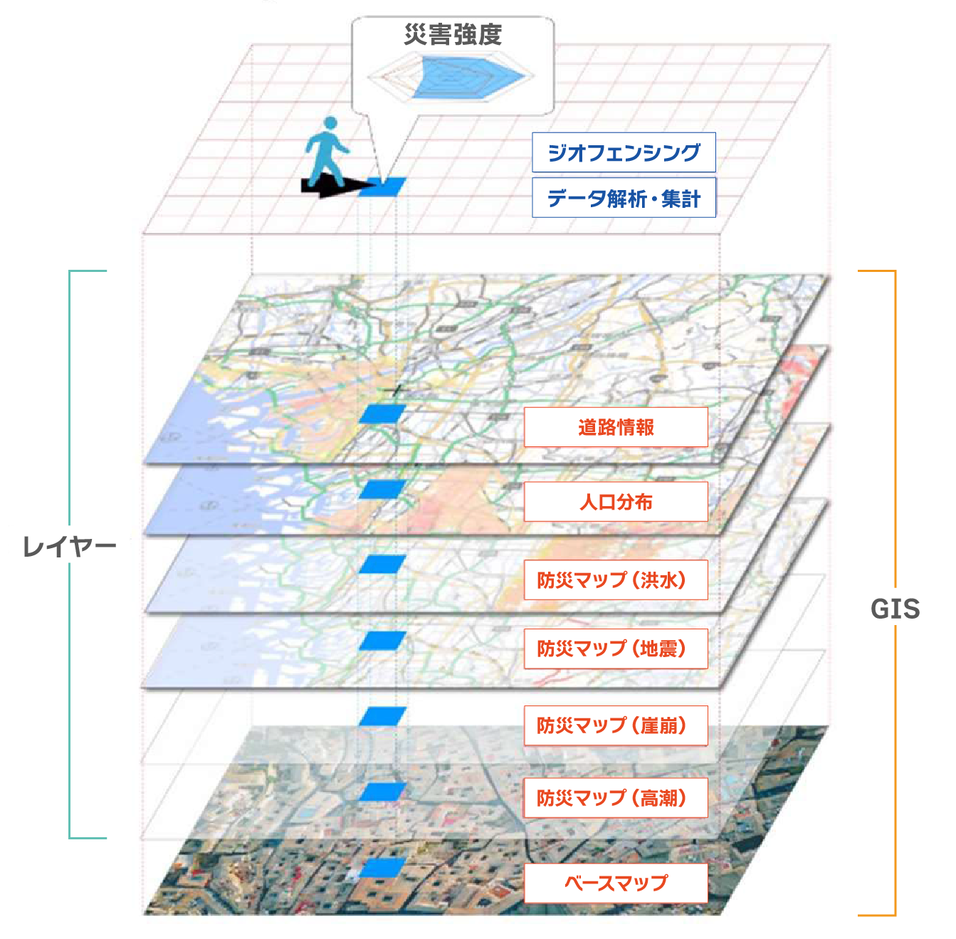
※地理情報システム(GIS:GeographicInformation System)
位置に関する情報を持ったデータ(空間データ)を総合的に管理・加工し、高度な分析や迅速な判断を可能にする技術

Cube Earthの導入事例
2022年6月
-歩けるイラスト地図-
Ambula Map
2021年11月
-神戸市-
スマート避難訓練

2019年3月
奈良平城宮跡
国土交通省-AR型公園案内アプリ
我々の独自技術
防災への応用
災害時の探索支援
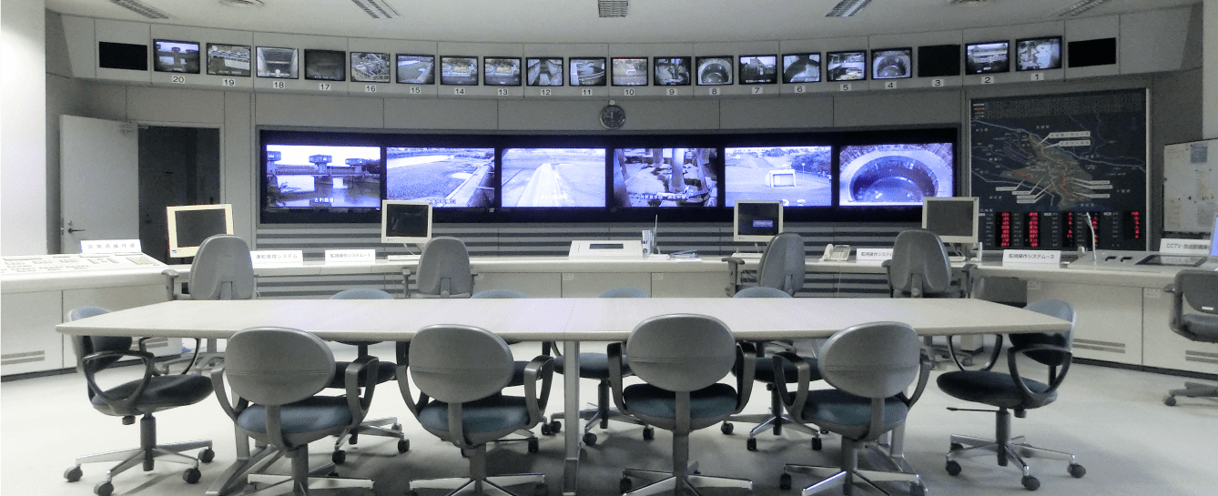
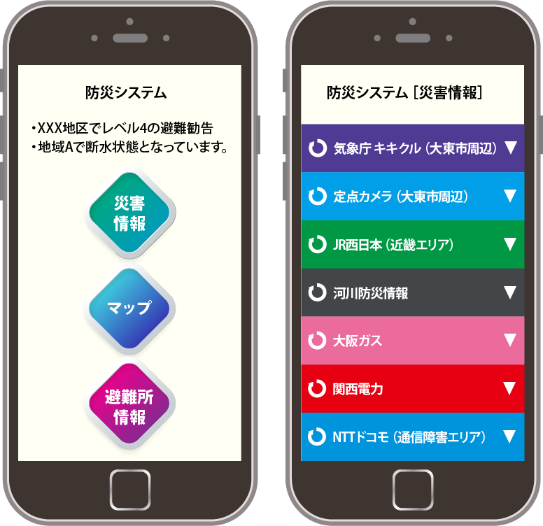
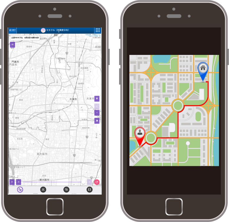
スマート防災システムについて
今後、30年以内に発生するといわれる東南海地震や昨今の異常気象によりいつ起こるかわからない自然災害に対して、今まで以上に住民の生命・財産を守るために対応を求められています。"災害対策のDXを行うことで"、被災状況や避難所の運営、避難者の管理などを一元管理できるシステムがスマート防災システムです。
危機管理業務をDX化して最適管理のメリット
-

-
- 災害に対する情報を一元化して庁内で共有
- 要支援者等に対する避難状況も含めた避難者名簿の作成
- 避難所の状況把握および必要(備蓄)物資等の在庫管理
- 災害収束後の情報分析
-

-
- 被災状況の確認
- 避難経路の確認
-
スマート防災システムの利用イメージ(行政)
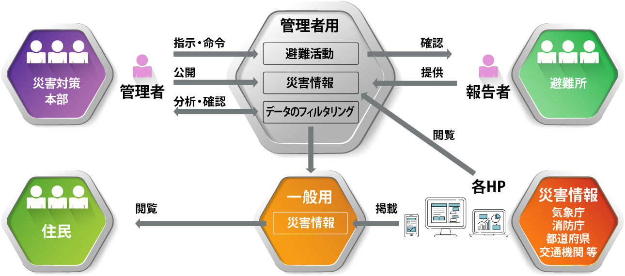
スマート防災システムの利用イメージ(市民)
-
- ● 災害情報を素早く確認
- ● インフラ情報等の必要な情報を簡単検索
- ● 避難所の情報(集積率、運営情報等)も
一元管理 - ● 災害時の避難所簡単経路検索
-
-
-
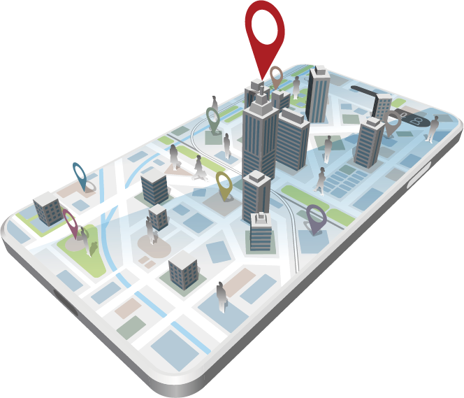
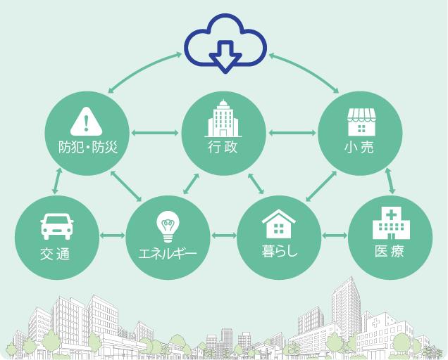
都市生活の質の向上を目指す「スマートシティ」
データ駆動型社会へ
スマートシティについて
移動・物流・インフラ・防災・気象・エネルギー・環境・観光等の個別分野のシステム構築とともに、都市・地域課題、
社会問題等を分野横断的に解決する取組を実施することを目的としております。(国土交通省)
位置のアドレスデータ付与技術について
従来の個別分野から横断的な全体最適化を実現
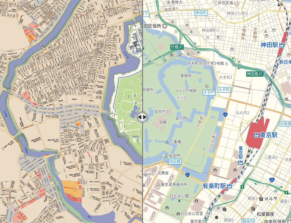
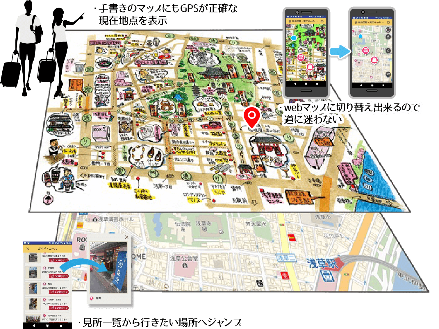
イラスト地図と標準地図の位置情報を同期して表示するサービス
古地図、観光マップと連携することで観光企画の実施、デジタルサイネージとして観光地のPRをすることができます。
-
1.マップをコンパクト(スマホ)に携行できる
たくさんの魅力的なイラストマップ/古地図をコレクション
-
2.イラスト上で、
 現在地点が分かる
デフォルメされた地図でも正確にGPSが機能する
-
3.Webマップと切替ながら道に迷わず
MapFanと交互に切り替えられる
-
4.ポップアップ情報で詳しく、新しく
管理画面から地点(名所、お店)の情報を登録更新
-
5.地図SNS
地点情報の投稿機能で、旅の記録としてそして、地図SNSを目指して
ドローンへの応用
ドローンの画像・地図連携
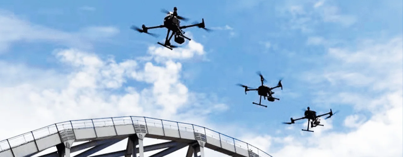
CubeEarthの想定しているドローンへの応用
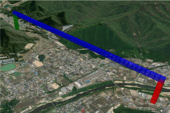
ドローンハイウェイサンプル
ドローンの航行可能の空間アドレスをピックアップや、速度制限などの情報を付加することでドローン航行用のハイウェイを作ることができます。
-
1.ドローンハイウェイの基盤データ
Global3Dメッシュを使ったドローン用の交通ルールが作成できる
-
2.データ連携による外部データの取り込み
都市基盤データ、気象情報、Project PLATEAU(国交省)等とデータ連携が可能
-
3.航行ルートの自動作成(最短経路問題が適用可能に)
隣接する3Dメッシュのネットワークデータの整備
-
4.複数のドローンの衝突防止
通過予定の空間アドレスをドローン間で共有することで衝突防止する
-
5.既存の管制システムと連携がしやすい
空間座標↔︎空間アドレスの変換が容易になる
-
6.目的地への座標指定が容易になる
最小1m単位での座標指定が可能
デジタルツインへの応用
製造業や都市などでの活用
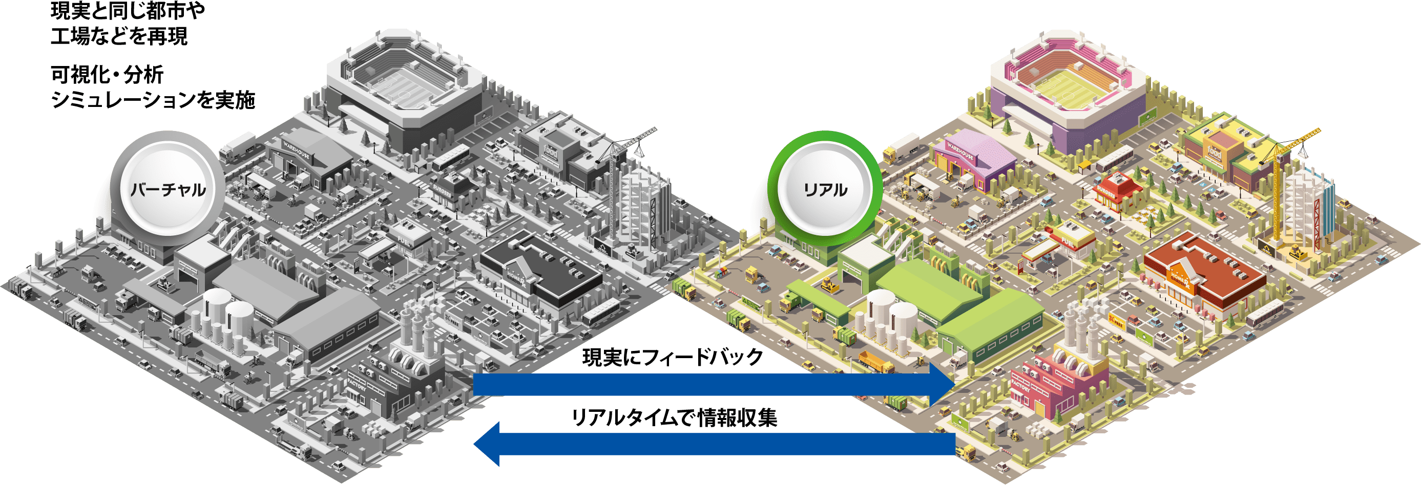
デジタルツインとは?
デジタルツイン(DigitalTwin)とは、現実の世界から収集した、さまざまなデータを、まるで双子であるかのように、
コンピュータ上で再現する技術です。
デジタルツインに活用されるおもなテクノロジー
- ● 試作期間の短縮・コスト削減
- ● 品質の向上・リスク低減
- ● 予知保全の実現
- ● 遠隔での作業支援・技能伝承
- ● 社会課題解決へのアプローチ
デジタルツインの仕組み(デジタルツインの概念図)
お知らせ

NEW
2026年4月22日
この度、弊社がBLUE Symphony株式会社様と開発した「XR可視化プラットフォーム「LASK」―非専門家でも即作成、高精度3D×現地ARで景観・誘導支援」が評価され、「ジャパン・レジリエンス・アワード(強靭化大賞)優秀賞」を受賞いたしました。
受賞内容 詳細PDF
ジャパン・レジリエンス・アワード(強靭化大賞)へのリンク
NEW
2026年4月22日
この度、弊社が株式会社モリタ様と開発した「大阪・関西万博における消防指揮支援システムの構築」が評価され、「ジャパン・レジリエンス・アワード(強靭化大賞)優秀賞」を受賞いたしました。
受賞内容 詳細PDF
ジャパン・レジリエンス・アワード(強靭化大賞)へのリンク
株式会社モリタ様HPのお知らせへのリンク
2025年5月3日
ラジオ音源①(mp3)
ラジオ音源②(mp3)
2025年4月23日
この度、弊社がシャープ株式会社様と開発した「山岳遭難者捜索における捜索隊の効率的かつ安全な捜索活動支援システム」が評価され、「ジャパン・レジリエンス・アワード(強靭化大賞) 最優秀賞」を受賞いたしました。
ジャパン・レジリエンス・アワード(強靭化大賞)へのリンク受賞内容 詳細PDF
2024年11月29日